In the late 19th century, on the western slopes of the village, a farmer uncovered an inscribed schist stone. The message was copied out but unfortunately the stone broke and got lost. The transcription, which was recently studied, indicates that it was a tombstone, inscribed in Latin, which dated from the 1st century CE. It is, therefore, a testament to the presence of Roman Rule in this village. The settlement must have continued to exist, but the mists of time have obscured any clearer glimpse into those days of old.
For Sarzedas, documented History begins in 1210, when King Sancho I (who reigned from 1185 to 1211), also known as The Populator, requested that the municipality of Covilhã give him a herdamento (an inheritance) of its land, so that the he could hand it to his bastard son, D. Gil Sanches and to the noble clergyman, D. Paio Pais, his archdeacon. The municipality of Covilhã – whose own charter had been granted by the same king in 1186 - responded: "I, the Alcayde, and we, the dignitaries of the municipality of Covilhã have seen the letters from our lord King Sancho, in which he ordered us to request an inheritance with lands for his son D. Gil Sanches and for Pero Pais, each of whom should own half. We give it as our lord king orders, such that it may be populated, built and farmed, and the inhabitants recognised as such within the confines of Covilhã." Covilhã relinquished the territory of Sarzedas, D. Gil Sanches was made Lord of Sarzedas alongside Paio Pais and it was granted its charter* in 1212, according to the customs of Covilhã, to restore and populate.
King Afonso II (who reigned from 1211 to 1223), confirmed this donation in a royal letter dated 1220. It is likely that as a result of these acts, Sarzedas built a fortified building atop Alto de S. Jacinto, of which nothing remains. In 1512, D. Manuel I granted the town its charter, which resulted in its pillory being raised. Around this time, Sarzedas was already under the domain of the Lords of Sarzedas e Fermosa (Sobreira Formosa). From 1630 to 1748, by royal writ issued by Philip III, it was under the domain of the Counts of Sarzedas, a title that was passed down to nine successors and ended with the death of the last countess, who left no direct heirs. From this date onwards, the town of Sarzedas and its surroundings became estates of the Crown. In 1762 – as Portugal was embroiled in the Seven Years' War, after refusing to get involved in the fight against its old allies, the English – the Country was invaded by Franco-Spanish troops. Sarzedas was occupied and it was here that the invading general, the Spanish Count of Aranha, set up his headquarters.
At the beginning of the 19th century, Sarzedas suffered the horrors of war once again, when Napoleon decided to invade Portugal. On 22nd November, 1807, the Loison Division entered Sarzedas. The list of crimes, plundering, arson and looting meant the settlement gained a sad notoriety: among other atrocities and sacrileges, they destroyed the interior and the property of the Mother Church. On 6th July, 1808, Napoleon's troops passed through Sarzedas once more, storming and pillaging the mother church, just as they had the previous year. In 1846, mutineers invaded the town hall, and removed and burned all its records. And so, part of the town´s history was lost in the flames. In 1848, Mouzinho da Silveira's administrative reforms abolished the municipality.
In the mid 20th century, Orlando Ribeiro described Sarzedas in the following way:
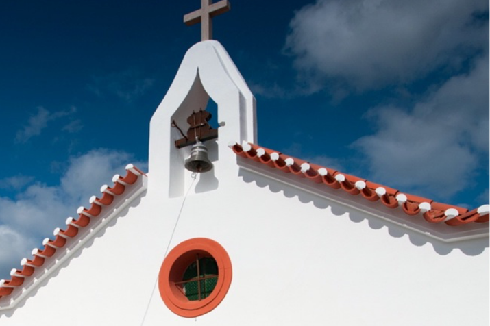
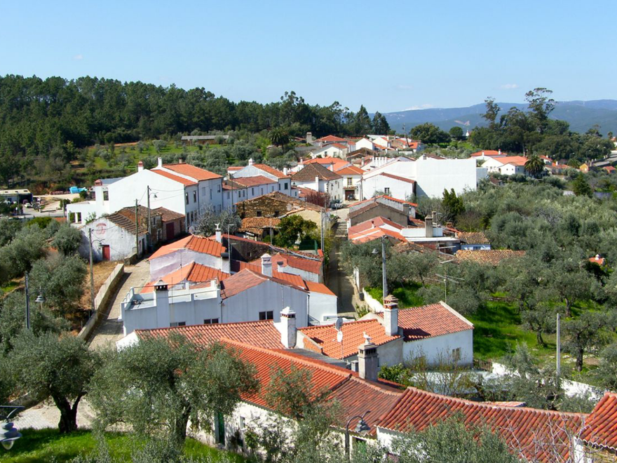
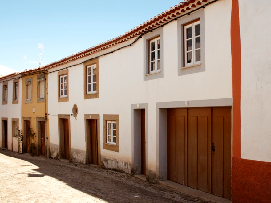
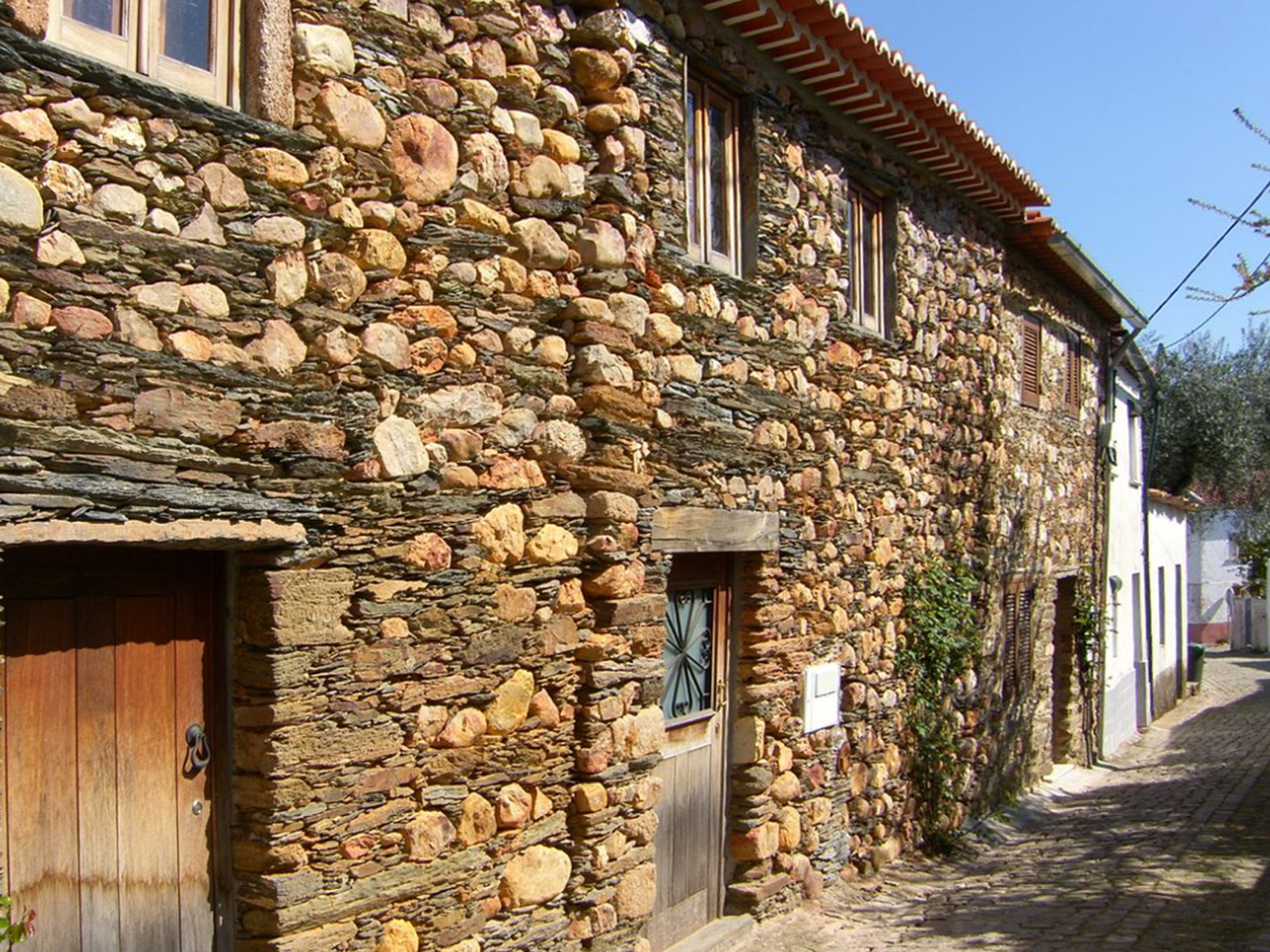
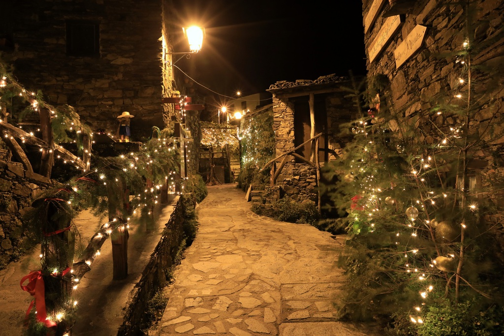
"The village consists of two streets lined with poor single-story houses, which lead towards the mother church, built on a hill. The schist of the walls in unrendered, in stacked slabs that have been semi prepared by nature for the rough rustic architecture. Lime washing is not a popular extravagance here on the heath, and the little town is all one dreary, plain brown hue."
in “Guia de Portugal - Beira Litoral, Beira Baixa, Beira Alta” (1944)
In 2012, Sarzedas commemorated the 800th anniversary of its first charter and 500th anniversary of its Manueline charter
*Charter: A medieval document which established the rights and duties of those living within the borders of a given location.
Origin of the name
The name has varied over the centuries: Sarzedas in the 14th century, Cerzedas in the 15th century,Cercedas in the . In one of the versions of the "Portugalliae" by Fernando Álvaro Seco, which is dated 1600 and is deemed to be one of the first cartographic representations of the whole continental Portuguese territory, we find Sarzeda at the location of the current village. The word "Sarzedas" is botanical in origin, its roots probably lying either in the root word "quercus", meaning oak, or in the term "Cereceda", a place full of cerejeiras or cerdeiras (both meaning “cherry trees”).
Counts of Sarzedas
The title created in 1630, by Filipe III, was used by various title holders. It is not possible to determine the extent of their presence in the village, if any. The title was preceded by that of Lords of Sarzedas e Fermosa, probably more closely tied to the place. The Counts of Sarzedas lived in the Palácio da Palhavã, in Lisbon, which currently houses the Spanish Embassy. Sarzedas is the only Schist Village attached to a noble title
D. Gil Sanches
(1202/1203 - 1236)
D. Gil Sanches was a bastard son of King Sancho I. He was raised in Vila do Conde and then, at the age of seven, as an inheritance from his father, became Lord of Sarzedas, with the assignment of being responsible for populating it. As an adult, he appears to have maintained a very close relationship with Sarzedas and its confines. In the “Livro Velho de Linhagens”, or Book of Lineage, c. 1290) he is described as being a highly honoured cleric in the Iberian Peninsula. As a medieval troubadour, he left us troubadour love poetry in the popular style, of the type belonging to the initial phase of the Cancioneiro Galaico-Português.
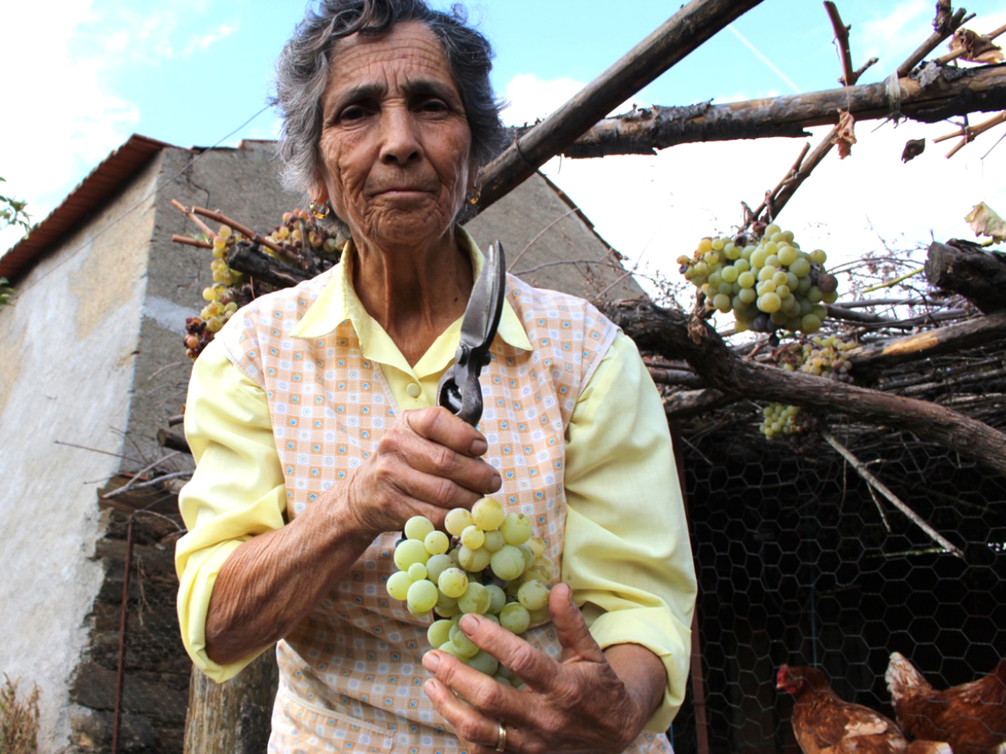
Night of St. John
In Sarzedas, only the perfumed rosemary branches picked from the fields during the day of the 24 July are burned on the bonfire on the night of St. John. As the bell tolls the last stroke of midnight on that day, the young women used to break an egg and put it into a glass full of water. The next morning, before sunrise, they would examine the whimsical shapes assumed by the egg. They would then interpret these shapes as being similar to some work instrument, object or tool linked to their future husband.